Photo by Iyus sugiharto on Unsplash
Zoom Rebrands As An AI-First Work Platform
- Written by Andrea Miliani Former Tech News Expert
Zoom announced a new change for its company name, from Zoom Video Communications Inc. to Zoom Communications Inc., and rebranded its business as an “AI-first company” yesterday.
In a Rush? Here are the Quick Facts!
- Zoom Video Communications Inc. changed its name to Zoom Communications Inc.
- The business was rebranded as an AI-first company, jumping into a new era where video isn’t its first focus
- Zoom AI Companion is now the main feature and the company is focusing on expanding AI capabilities
“Zoom is now about so much more than video meetings,” wrote Eric S. Yuan, the company’s CEO and founder in a public statement . “We are an AI-first company delivering modern, hybrid work solutions that enable you to collaborate seamlessly.”
As part of the company’s strategy to stay on top of new technologies and innovative trends, they have adopted AI as a “must-have” technology to integrate into its platform and with its customers. The company has been defined as an “AI-first company” with Zoom AI Companion, its AI assistant as its leading product.
Yuan also explained what it means to them to be an AI-first company: “Taking a federated approach to building AI-centric tools and products that enable you to work happier, smarter, and faster.”
The company’s CEO added that the current AI tools in Zoom Workplace are helping users focus more, summarize meetings, and perform other tasks to reduce workload, but expect, in the future, to expand their AI capabilities towards more free time for workers.
Zoom has launched multiple AI features to compete in the AI market. In August, the company launched Zoom Docs , an AI-powered document editor for Pro accounts to turn Zoom Meetings into documents. Last month, Zoom released AI Companion 2.0 , an upgraded version of its chatbot to help users finish tasks and stay organized.
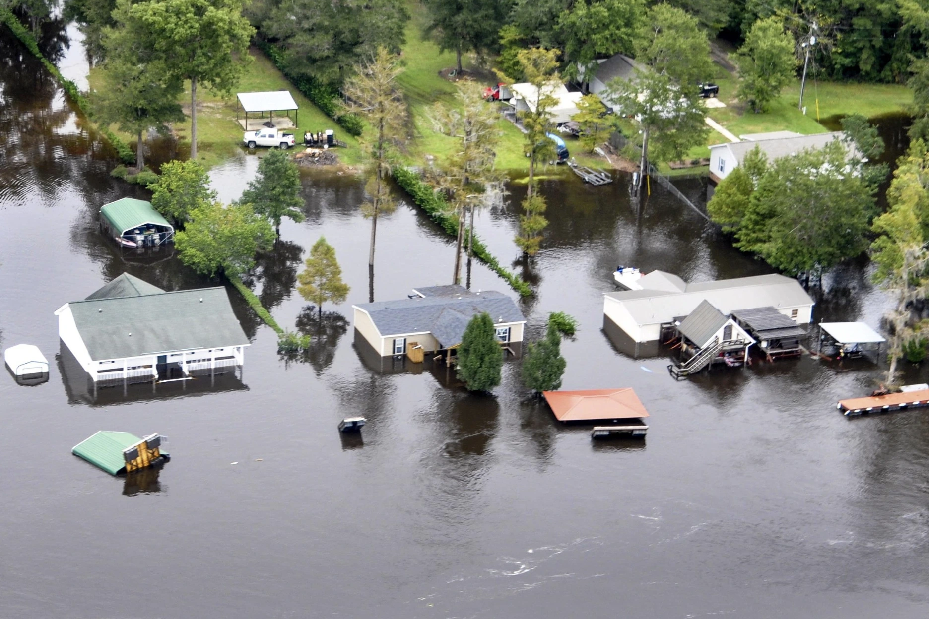
Image from Garrison Flood Control
AI Tool Simulates Flood Scenarios With Realistic Satellite Images
- Written by Kiara Fabbri Former Tech News Writer
- Fact-Checked by Sarah Frazier Former Content Manager
MIT’s AI tool simulates realistic flood images using physics-based models, aiding communities in visualizing climate risks and preparing for hurricanes.
In a Rush? Here are the Quick Facts!
- Tested in Houston, it visualizes potential flooding similar to Hurricane Harvey’s impact.
- Current flood maps use color codes; this adds realistic satellite-like imagery.
- Researchers call it a step forward in climate-risk visualization and public preparedness.
MIT researchers have developed an artificial intelligence tool that combines generative AI with physics-based models to create realistic satellite images of potential flooding.
The technology could provide a new way for communities to visualize the impacts of storms and make informed decisions about evacuation and preparation. The team has made their “ Earth Intelligence Engine ” method available online for others to explore.
The team tested the approach in Houston, Texas, simulating flooding caused by a storm similar to Hurricane Harvey.
By generating satellite images that represent how specific areas might look after such an event, the researchers compared the results to actual satellite images taken after Harvey.
Their findings revealed that combining AI with a physics-based flood model produced more accurate depictions of flooding than AI alone, which sometimes generated unrealistic results, such as flooding in higher-elevation areas.
The tool employs a machine learning method called a conditional generative adversarial network (GAN). The GAN consists of two neural networks: one generates synthetic images, while the other evaluates their accuracy against real data.
While effective, the process can result in visual inaccuracies, or “hallucinations,” when used on its own. To improve reliability, the team integrated the GAN with a physics-based model that accounts for real-world factors like storm trajectories, wind patterns, and flood infrastructure.
The researchers believe this combination of AI and physics could enhance current methods of flood risk communication, which often rely on color-coded maps.
“The idea is: One day, we could use this before a hurricane, where it provides an additional visualization layer for the public,” said Björn Lütjens, a postdoctoral researcher who led the study.
“One of the biggest challenges is encouraging people to evacuate when they are at risk. Maybe this could be another visualization to help increase that readiness,” he added.
The research, published in IEEE Transactions on Geoscience and Remote Sensing, highlights a potential use of AI in risk-sensitive contexts.
